Vectiq MLOps Geo - Digital Map & Satellite Imagery
Imagery catalogued by period and served as basemap tiles, a versioned map database, an editor built on Rapid, and crowdsourced review with consensus and contributor tiers
Overview
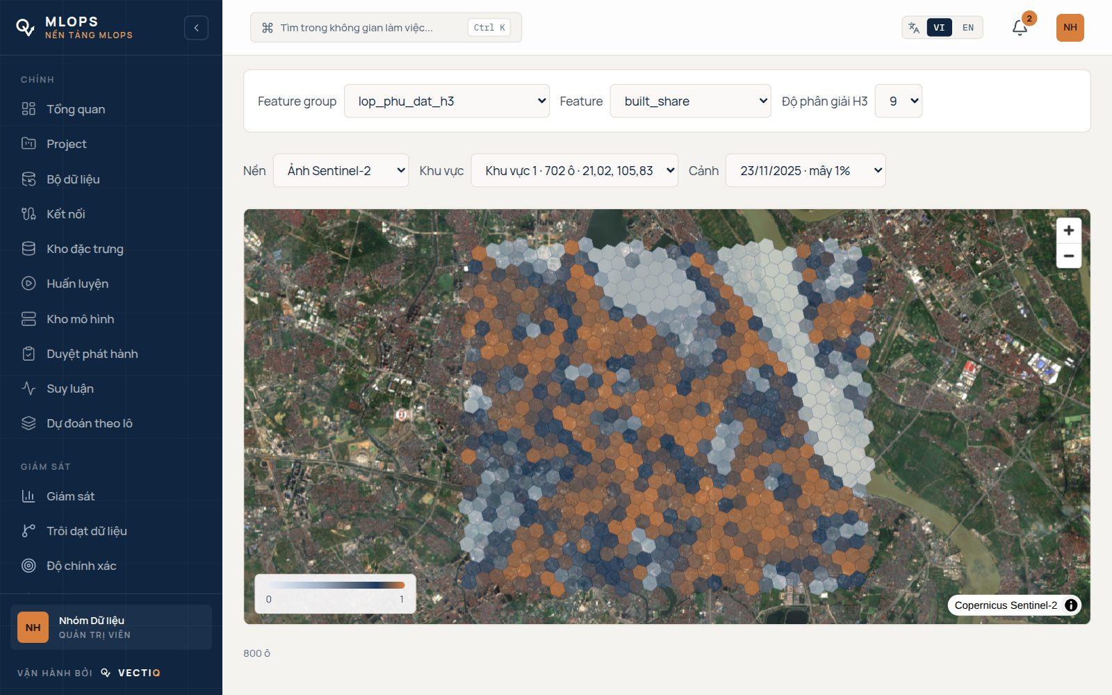
Vectiq MLOps Geo is the map module of Vectiq MLOps: it runs in the platform's own dashboard and uses its models, endpoints and monitoring for the imagery work. It is built in three layers.
At the bottom is imagery: a STAC catalogue of Sentinel-2 scenes over Vietnam, cloud-free composites per year, quarter or month, and purchased high-resolution imagery that is archived untouched before it is orthorectified, pansharpened and converted to COGs.
Each collection is offered as an XYZ layer per period, pre-rendered to PMTiles at low zooms and rendered on demand above that, so a web map or an editor can pick a source and then a year. In the middle is the map itself: roads, buildings, water and POIs stored as versioned objects with stable ids, edited through changesets with optimistic locking, released as snapshots and exported as .osm.pbf for routing.
OpenStreetMap data is synced in without overwriting anything a person has corrected. On top are the people. The Geo Editor is built on Rapid, Meta's open-source OSM editor; we connect it to the map database through an OSM API facade, so Rapid's own editing and conflict handling work unchanged, and AI candidates such as buildings segmented from Sentinel-2 appear orange and dashed until someone confirms them.
A quality score per H3 cell decides where tasks are needed, tasks carry gold questions and are settled by consensus, and volunteers, paid contractors and MapOps staff each get exactly what their tier allows. The workbench and editor run on a pilot deployment open to outside contributors over Hà Nội and TP.HCM; the Sentinel-2 imagery layers are not yet served in production.